


You’ll find a range of white papers, technical reports, studies, and in-depth analyses from our experts.
Our publications below are available on request.
You’ll find a range of white papers, technical reports, studies, and in-depth analyses from our experts.
Our publications below are available on request.
| Document Title | Abstract | Author(s) | Source | Year | Sector | Request | hf:doc_categories | hf:doc_author | hf:doc_tags |
|---|---|---|---|---|---|---|---|---|---|
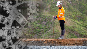
| Future proofed tunnels at Karang-a-hape Road Station | Karangahape Road Station will be a new underground station on the Contract C3 of City Rail Link project in Auckland. The C3 comprises of 3.5 km twin-tunnel underground rail underneath Auckland’s city centre, two new underground stations at Aotea and Karangahape and expanded station at Mount Eden. The Karangahape Road Station is a 30 M-deep mined binocular underground station, with two shafts, platforms, lifts, escalators, rooms housing station and tunnel services equipmewnt, and an entrance at Merciry Lane and Beresford Square. Show more…This paper presents the story of the future proofing through project development of the station design, starting as a six-car station with a single entrance in reference design. The station will be built to accommodate nine-car trains. One of the key decisive facors being unprecendented increase in rail patronage in Auckland. Longer platform tunnels extended the tunnel mining to zones of shallow overburden and demands for tunnel ventilation brought challenges for ground support of large span platform tunnels at junctions with ventilation adits.Show less… | Howard J C, Howard Katerina | 17th Australasian Tunnelling Conference, 2021, Melbourne | 2021 | Land + Buildings | land-buildings | howard-j-c howard-katerina | 2021 | |
| Design and construction of rammed aggregate piers for Te Kaha – Canterbury’s new multi-use arena | Geopier Rammed Aggregate Piers® (RAPs) are a ground improvement technology that creates a densified column of aggregate surrounded by a stiffened matrix soil. This paper describes the design and construction of RAPs at Te Kaha, a $683- million Multi-Use Arena under construction in Christchurch, New Zealand. Show more…CLL Projects are constructing 8331 RAPs including 1092 tension RAPs to depths between 5.5 to 12m to provide a ground improvement system supporting the arena. Design considerations include estimation of soil densification in a wide range of soil conditions (sand, silty sand, silt and gravel), analysis of liquefaction triggering before and after ground improvement, numerical analysis to predict the bearing capacity and settlement of the foundations, and prediction of uplift capacity for tension RAPs. The design predictions and the actual results from verification testing are compared, including pre- and post- improvement CPTs and tension load tests. At Te Kaha the RAP installation resulted in a significant increase in sandy soils between the RAP elements. The CPT results consistently underestimated the fines content of the soil. The tension load test results showed that the uplift capacity is dependent on the soil conditions at the tip of the tension RAP. If adequate confinement cannot be achieved at the base the tension RAP ‘unravels’ and the capacity is much lower than typical design methods would predict.Show less… | Bowen Hayden | 14th Australia New Zealand Conference on Geomechanics, Cairns, 2023 | 2023 | Land + Buildings | land-buildings | bowen-hayden | 2023 | |
| Geotechnical application and benefits of performance-based design | The New Zealand Building Code (like many others) is a performance-based standard; however, the application of performance-based design is rare in practice. Typical design practice considers the capacity of individual elements in the building and does not allow for the full load-displacement response of the building system. Show more…This paper presents a case study where a performance-based design approach was used for the design of a new building on an existing foundation system and how it was able to illustrate compliance with the New Zealand Building code. The case study found that a capacity-based design approach was likely an impractical way to illustrate compliance with the Building Code. Given the significant negative project impacts including programme delays, environmental impacts and cost increases associated with adopting a new foundation system, a performance-based assessment was completed. With strong interaction between the geotechnical and structural engineers, a non-linear vertical pile spring analysis was undertaken, allowing the design team to demonstrate that the existing foundation system complied with the building code, avoiding the significant negative project impacts.Show less… | Robinson James, Storie Luke B, van Ballegooy Sjoerd | 14th Australia New Zealand Conference on Geomechanics, Cairns, 2023 | 2023 | Land + Buildings | land-buildings | robinson-james storie-luke-b van-ballegooy-sjoerd | 2023 | |
| Shear behaviour of a heavily-overconsolidated claystone deposit | Claystone deposits are commonly intercepted in road slope cuttings, for example in Southern Queensland and thus the understanding of the shear behaviour of these deposits is important for geotechnical engineers for design, construction, and maintenance works. These sedimentary deposits are often weakly bonded, and the engineering behaviour is akin to heavilyoverconsolidated plastic clays. Show more…Apart from difficulties in sampling these deposits, interpretation of shear behaviour in triaxial tests is often challenging. The paper presents the results of a triaxial investigation and discusses some of the challenges involved in the conduct and interpretation of the results. Further, the pitfalls of directly using the laboratory shear results at the field scale are highlighted, drawing attention to the potential for progressive and delayed failures that are observed in the field. Some requirements for constitutive modelling for numerical analysis are also emphasized.Show less… | Dissanayake Ajith, Sivakumar Siva, Wijeyakulasuriya Vasantha | 14th Australia New Zealand Conference on Geomechanics, Cairns, 2023 | 2023 | Land + Buildings | land-buildings | dissanayake-ajith sivakumar-siva wijeyakulasuriya-vasantha | 2023 | |
| Rawene Reserve landslips emergency response and stabilisation | The Rawene Reserve landslips occurred in 2017 and resulted in the partial loss of a sealed carpark behind the Mokoia Road shops in Birkenhead, Auckland. The landslips are inferred to have occurred within uncontrolled fill materials placed in a gully during the 1960s and 1970s, and along softened and pre-sheared zones within residually weathered soils of the East Coast Bays Formation. Show more…The main landslip formed a debris flow of material which travelled up to 300 m downslope damaging local infrastructure, and inundating properties and local streams. Emergency action and stabilisation measures were undertaken by Auckland Council to prevent further movement, to make the surrounding area safe and allow for longer term repair works. Stabilisation measures included temporary sheet piles, cantilevered timber pole walls, an anchored concrete piled palisade wall, earthworks, and subsoil drainage. Engineered fill was placed to buttress the slope and form a new carpark. Construction was completed and the carpark reopened in October 2019, two years after the initial landslip event. Monitoring of strain in the piles using rebar strainmeters confirmed pile performance. The project was challenging given its urban location, multiple affected stakeholders and the emergency response required.Show less… | John Seward, Simon Farquhar | Proceedings of the 7th International Young Geotechnical Engineers Conference, 2022, Sydney | 2022 | Land + Buildings | land-buildings | john-seward simon-farquhar | 2022 | |
| The use of Trigger Action Response Plans to mitigate wave overtopping hazard on coastal infrastructure | Wave overtopping of coastal infrastructure such as rail, road and shared pathways can be hazardous to users and potentially threaten structural integrity and reliability. A Trigger Action Response Plan (TARP) provides a robust framework for mitigating risk by defining response actions based on escalating trigger levels. Show more…These actions, and their expected frequency of occurrence can be implemented into construction or operational programs and adjusted as new data becomes available or engineering modifications are made. | Francois Flocard, Patrick Knook, Peter W. Quilter, Richard Reinen-Hamill, Tom D. Shand | Australasian Coasts & Ports 2021 Conference, Christchurch | 2021 | Water | water | francois-flocard patrick-knook peter-w-quilter richard-reinen-hamill tom-d-shand | 2021 | |
| Wave-structure-soil interaction for Te Wānanga, Auckland’s new waterfront | Te Wānanga, Auckland’s new waterfront public space, is part of the Downtown Infrastructure Development Programme, which aimed to revitalise the waterfront of downtown Auckland through a series of interconnected projects. The public space comprises an approximately 1,600 m2 suspended reinforced concrete wharf, featuring both an irregular seaward edge and numerous irregularly shaped apertures for architectural features. Show more…These include deck-mounted suspended steel planters which hold large Pōhutukawa trees, woven suspended nets, open apertures with sculpted steel balustrades and suspended mussel floats and ropes, as well as a series of safety piles along the seaward edge. Te Wānanga aims to blend the boundary between the city and the harbour with its architectural design inspired by New Zealand’s coast and culture. The unique architectural form, the low-lying deck level, proximity to Quay Street seawall, interface with simultaneous projects, and time pressure all added technical complexity. Overcoming this required in-depth analysis of wave-structure-soil interaction and close collaboration with the project partners. Development of a comprehensive structural model allowed for geometrical complexity to be accurately considered for rapid assessment of alternative construction staging options and for sensitivity analyses to varying ground conditions to be carried out. This allowed risks associated with unforeseen ground conditions during the construction phase to be managed. An adaptive design approach allowed for the architectural form of the low-lying deck to be retained whilst managing the future risk of wave overtopping through the later raising of the deck level. Wave uplift proved to be a significant load, especially for future sea level scenarios over the design life. However, seismic loading and durability considerations provided the critical design case scenarios..Show less… | Alex Vink, Andrew Brown, Emma Bullivant, Luke B. Storie | Australasian Coasts & Ports 2021 Conference, Christchurch | 2021 | Water | water | alex-vink andrew-brown emma-bullivant luke-b-storie | 2021 | |
| Marine habitat enhancement and fauna management at Cobham Drive, Wellington | Cobham Drive, Wellington, is the site of a newly constructed footpath and cycleway with 430 m of associated erosion protection in the form of rock revetment. Habitat enhancement over and above rock placement was required to provide habitat complexity and enhanced ecological function post-construction.Show more… | Marcus Cameron, Michael Paine, Susan Jackson | Australasian Coasts & Ports 2021 Conference, Christchurch | 2021 | Water | water | marcus-cameron michael-paine susan-jackson | 2021 | |
| Developments in the mapping of coastal erosion susceptibility/hazards | Areas susceptible to coastal erosion have traditionally been mapped as lines on a map. This was based on single values that were derived using a ‘building block’ approach. More recently, coastal erosion extents have been assessed probabilistically to account for environmental and data uncertainty. Nonetheless, single lines are still typically mapped for selected probabilities of exceedance. Show more…Often, many lines are mapped because of specific sea level rise scenarios, timeframes and selected probabilities of exceedance that are typically considered and this can be confusing for stakeholders. Furthermore, coastal erosion extents can also be useful when undertaking risk assessments for coastal adaptation planning, but single lines are of limited value. | Charles Lan, Eddie Beetham, Matt de Boer, Patrick Knook, Rebekah Haughey, Richard Reinen-Hamill, Ross Roberts, Tom D. Shand | Australasian Coasts & Ports 2021 Conference, Christchurch | 2021 | Water | water | charles-lan eddie-beetham matt-de-boer patrick-knook rebekah-haughey richard-reinen-hamill ross-roberts tom-d-shand | 2021 | |
| Hydrodynamic modelling of tsunami inundation behaviour in urban environments | Tsunami pose a significant risk to many urban centres in New Zealand. Having methods to assess the extent and flow regimes of tsunami allow the development of appropriate mitigation measures. Simulation of tsunami inundation using numerical methods has typically been undertaken assuming a bare-surface terrain with roughness coefficients applied based on land cover, rather than incorporating buildings and vegetation into the elevation model. Show more…This is often a consequence of computational limitations restricting the spatial resolution able to be modelled during large-scale tsunami inundation assessments. These coarse resolutions mean that buildings and infrastructure are unable to be realistically modelled. This is of particular concern in dense, urban environments where tsunami flow characteristics are likely to be strongly influenced by built infrastructure. | Pablo Higuera, Scott Murray, Tom D. Shand | Australasian Coasts & Ports 2021 Conference, Christchurch | 2021 | Water | water | pablo-higuera scott-murray tom-d-shand | 2021 | |
| Physical modelling of complex overtopping flows at Ōhau Point, Kaikōura and development of mitigation measures | A magnitude 7.8 earthquake struck the Kaikōura coastline in November 2016 causing widespread uplift and landslides closing State Highway 1 and Main North Rail Line. Ōhau Point was the location one of the largest and most challenging landslides, with more than 160,000 cubic meters of rock falling from the surrounding cliffs and inundating the road and rail corridors. Show more…Recovery works by the North Canterbury Transport Infrastructure Recovery (NCTIR) Alliance reinstated the roadway further seaward and at a lower level than previous due to residual landslide and rockfall risk. A unique combination of steep offshore bathymetry and rock outcrops resulted in focusing of wave energy and overtopping to occur at a higher frequency and magnitude than was initially expected. This overtopping presented a potential hazard to road users and to the road infrastructure itself during extreme events. This paper presents the results of extensive physical modelling undertaken at the Water Research Laboratory at UNSW Sydney to investigate the overtopping processes and to assist NCTIR in evaluating options for mitigating hazard at the site. The section of road and seawall at the site is fronted by a nearshore zone with highly complex bathymetric features, and as such, a quasi-threedimensional model was required to simulate the complex 3D effects of the nearshore wave field and overtopping process.Show less… | Francois Flocard, Mathieu Deiber, Matt J. Blacka, Patrick Knook, Steve Procter, Tom D. Shand | Australasian Coasts & Ports 2021 Conference, Christchurch | 2021 | Water | water | francois-flocard mathieu-deiber matt-j-blacka patrick-knook steve-procter tom-d-shand | 2021 | |
| Temporarily permanent – creating the stage for the 36th Americas Cup | In June 2017 Emirates Team New Zealand defeated Oracle Team USA, seizing the opportunity to host the 36th America’s Cup on the Waitematā Harbour in Tāmaki Makaurau Auckland. Auckland last hosted this international sporting event in 2003. Continued urban regeneration along Auckland’s waterfront meant that the previous event infrastructure had since been redeveloped for other uses.Show more… | Bridget Allan, Jennifer Hart, Joe Greene, Niksa Sardelic, Tom D. Shand, William Ingle | Australasian Coasts & Ports 2021 Conference, Christchurch | 2021 | Water | water | bridget-allan jennifer-hart joe-greene niksa-sardelic tom-d-shand william-ingle | 2021 | |
| Design of controlled modulus columns without load transfer platform | Ground improvement by means of Controlled Modulus Columns (CMCs) usually involves the construction of a Load Transfer Platform (LTP) over the CMCs, especially for construction of low embankments over soft soil, to carry the overburden load and transfer to the CMCs, thereby not loading the surrounding soft soils, and avoiding excessive total and differential settlement. Show more…This paper provides a case study of a design undertaken for CMCs without an LTP, taking advantage of a relatively high embankment (4.5 m). Compacted fill and gravel working platform layers have been considered to be sufficient to dissipate any differential settlement at the surface of the embankment, without a need for an LTP. Available settlement monitoring data has confirmed the settlement to be within tolerable limits. Advantages of this method include time and cost savings, as well as environmental benefits.Show less… | William T. Eom | 14th Australia & New Zealand Young Geotechnical Professionals Conference, Rotorua, 2022 | 2022 | Land + Buildings | land-buildings | william-t-eom | 2022 | |
| Co-design of an innovative urban shellfish restoration project | A public open space on the Tāmaki Makaurau waterfront known as ‘Te Wānanga’ has been constructed as part of a wider transformation of the Tāmaki Makaurau downtown area. The project constitutes a tidal shelf of interconnected spaces, a coastal forest, and apertures to the sea below. Green-lipped mussel (kūtai) restoration is incorporated into the design, with the aim of re-establishing ‘living’ systems in the Tāmaki Makaurau urban marine environment. Show more…Māori knowledge and philosophy have strongly influenced the co-design process. Green-lipped mussels were once abundant in the Hauraki Gulf, before overfishing and pollution caused stocks to collapse in the mid-1900s. Successful translocations of mussels have been undertaken as part of the ‘Revive our Gulf’ project, but have not previously been attempted in the Tāmaki Makaurau city centre. Trials of pile wraps and a novel floating buoy system seeded with mussels were deployed in June 2020, to inform the final deployment in May 2021. Success criteria include survival and growth rates of mussels, and establishment of other native and non- native species, with the aim of providing targeted substrate and systems to enhance native biodiversity. So far, the mussels are holding their own, and attracting other native species even in this heavily impacted environment. However, as seen in other urban marine environments, there is competition from invasive species such as Undaria and the Mediterranean fanworm. Given its location in the heart of the city the project provides an excellent opportunity to educate the general public about pollution and invasive species, and to showcase the cultural and ecological benefits of shellfish restoration through a co-design process.Show less… | Alex Foxon, Alex Vink, Jarrod Walker, Marcus Cameron, Richelle Kahui-McConnell, Susan Jackson | Australasian Coasts & Ports 2021 Conference, Christchurch | 2021 | Water | water | alex-foxon alex-vink jarrod-walker marcus-cameron richelle-kahui-mcconnell susan-jackson | 2021 | |
| Optimisation of a falling toe for river mouth scour protection – results from a physical model study | River mouths are often highly dynamic environments, fluctuating in location and depth with riverine and coastal processes. Where river training structures restrict the river to a fixed location, these structures must be protected against the effects of scour occurring within the main channel. Show more…One possible toe protection method is to construct a “falling toe” (or “falling apron”) to launch material onto the developing slope formed by the scour. Data from physical model studies and field installations are limited, making it difficult to assess the general behaviour of the falling toe during the scour process and therefore the optimal placement volume and geometry. | Bruce W. Melville, Colin Whittaker, Eddie Beetham, Grant W. Pearce, Jonathan Clarke, Josh Joubert, Lance D. Partner, Tom D. Shand, Zihao Tang | Australasian Coasts & Ports 2021 Conference, Christchurch | 2021 | Water | water | bruce-w-melville colin-whittaker eddie-beetham grant-w-pearce jonathan-clarke josh-joubert lance-d-partner tom-d-shand zihao-tang | 2021 | |
| Performance and sustainability options assessment of a building with a concrete raft foundation overlying liquefiable soil | Communication and interaction between the project structural and geotechnical engineers are critical to obtain an efficient building solution for the site, building owner and occupants. This is particularly important at concept development phase when building form and type is being assessed. This paper provides a case study of soil-structure interaction and the holistic concept development of a four-storey apartment type building and concrete raft foundation overlying potentially liquefiable soil. Show more…It examines how a lightweight structure can have benefits from a sustainability, seismic performance, and overall cost perspective. The site comprised liquefiable soils approximately 3 m below foundation level. The Structural Engineer and Geotechnical Engineer worked together to examine the seismic and sustainability performance of a robust reinforced concrete raft foundation for three potential superstructure types: timber, reinforced concrete and steel. For simplicity, this paper presents the two maximum and minimum structural types for seismic performance and sustainability, being reinforced concrete and timber. It was established that the seismic performance of a lightweight timber structure was significantly improved compared to a conventional concrete structure. As a result, the timber structure option only required a 400 mm thick concrete raft. Whereas the conventional concrete structure option required a 900 mm thick concrete raft with poor seismic performance, and potential for additional ground improvements. It was also assessed that the timber structure option had significantly less embodied carbon compared to a conventional concrete structure. A major contribution to this was the differences in the concrete raft thickness. The improvement in foundation design, improvement in seismic performance, and reduction in embodied carbon contributed to the building owner’s selection of the timber structure concept and avoided the need for expensive ground improvement.Show less… | Guy McDougall, Jamie Thompson, Mark Thomas, Sjoerd van Ballegooy | 14th Australia & New Zealand Young Geotechnical Professionals Conference, Rotorua, 2022 | 2022 | Land + Buildings | land-buildings | guy-mcdougall jamie-thompson mark-thomas sjoerd-van-ballegooy | 2022 | |
| Combined numerical and physical modelling of waves for Ōpōtiki Harbour entrance design | The Ōpōtiki Harbour Development Project involves stabilising the entrance of the Waioeka River to allow reliable and safe access for maritime activity. This project is the first major river training works to be designed in New Zealand in over 100 years and includes twin 400 m long training wall breakwaters, dredging of a navigable channel into the harbour, and closing the natural river mouth. Show more…Accurate definition of wave height reaching the structure is a key design parameter for armour sizing, setting crest elevation and determining wave penetration into the harbour. To model wave processes for the design, a high-resolution numerical wave model was required to resolve nearshore transformation, refraction, diffraction, and reflection off the structure. The fully non-linear Boussinesq model Funwave-TVD was used to for this work, in conjunction with physical modelling in the wave basin with WRL. This paper discusses how numerical and physical modelling methods were used in a complementary and iterative manner to inform and test the design. Reflection was a key consideration during the modelling work. Reflection and any resulting convergence needed to be accounted for within the breakwater channel, however, amplification from reflection radiating out to the open sea needed removing to optimise the unit sizing. Wave reflection in the numerical model was assessed using a range of linear and directional spectral methods, with limited success. Improved handling of reflection for the design objective was achieved by repeating simulations with and without the breakwater structures. Reflection off the structures was controlled in the numerical model using a local friction on the breakwater face that achieved a reflection coefficient of 0.3-0.4 to match physical modelling observations. Physical modelling results were also used to validate and calibrate the numerical model. A scaled version of the final design was tested in a 3D physical model for confirmation of stability.Show less… | Eddie Beetham, Francois Flocard, Grant W. Pearce, Jonathan Clarke, Lance D. Partner, Patrick Knook, Tom D. Shand | Australasian Coasts & Ports 2021 Conference, Christchurch | 2021 | Water | water | eddie-beetham francois-flocard grant-w-pearce jonathan-clarke lance-d-partner patrick-knook tom-d-shand | 2021 | |
| Ōpōtiki Harbour Development Project – Design of New Zealand’s first river training works in over 100 years | The Ōpōtiki Harbour Development Project involves stabilising the entrance of the Waioeka River to allow reliable and safe access for maritime activity. This project is the first major river training works to be designed in New Zealand in over 100 years and involves construction of twin 400 m long training wall breakwaters, dredging a navigable channel into the Harbour, and closing the natural river mouth. Show more…The design solution chosen involves conventional rubble mound breakwaters armoured with Hanbar concrete armour units and includes a wide rock armoured toe apron. Design of the Harbour entrance breakwaters has involved a complex process of defining both coastal and river design parameters that input into the detailed design of the structures. Key aspects of both coastal and river processes were modelled numerically and physically with the results of the modelling feeding into the detailed design of the structures. Data obtained from site investigations was used to inform and calibrate the modelling and design decisions alongside predicted climatic changes to the coastal and river hydrology over the design life of the structures. Compared to the engineers of 100 years ago we have a greater understanding of the construction environment and more design tools, however this creates additional challenges. This paper discusses how the respective models were used to calibrate and evaluate the design parameters from both coastal and river processes. It also discusses some of the design philosophy and decisions made during detailed design particularly in relation to design wave height and the effects of waves against currents, the choice of KD value for stability design of the armour units, calibration of the calculated and modelled wave overtopping flows, requirements and feasibility for ground improvements, and the design philosophy behind the choice of toe apron design..Show less… | Eddie Beetham, Francois Flocard, Grant W. Pearce, Guy McDougall, Jonathan Clarke, Lance D. Partner, Mark Pennington, Patrick Knook, Tom D. Shand | Australasian Coasts & Ports 2021 Conference, Christchurch | 2021 | Water | water | eddie-beetham francois-flocard grant-w-pearce guy-mcdougall jonathan-clarke lance-d-partner mark-pennington patrick-knook tom-d-shand | 2021 | |
| Real world observations for sulfur dioxide and particulate matter due to the reduction in marine sulfur fuel content from Marpol Annex VI | On 1 January 2020, the allowable sulfur content of marine fuels, as capped under Annex VI of the International Convention for the Prevention of Pollution from Ships (MARPOL), fell from 3.5 percent by weight to 0.5 percent by weight. Although, at the time of writing, New Zealand had not yet acceded to Annex VI, all ocean-going ships entering New Zealand ports are flagged to states that are party to Annex VI. Show more…Therefore, the effects of the Annex VI ‘Sulfur 2020’ Regulations are expected to largely have been realised. Monitoring for sulfur dioxide and PM10 is undertaken by the Bay of Plenty Regional Council at a number of sites in the Mt Maunganui area close to the Port of Tauranga, which is the largest port in New Zealand in terms of total cargo volume. The monitoring data has been investigated to evaluate the impacts of the Sulfur 2020 Regulations on sulfur dioxide and particulate matter air quality in the Mt Maunganui area. The paper also considers what further air quality improvements might be observed once New Zealand accedes to Annex VI.Show less… | Danny B Beasant | 26th CASANZ (Clean Air Society of Australia & NZ) Conference 2022, Adelaide | 2022 | Waste + Resource Recovery | waste-resource-recovery | danny-b-beasant | 2022 | |
| Anchor investigation in weak, soft, mudstone to assess the impacts of flush type and potential of underream methods | When installing anchors in weak argillaceous rocks selecting appropriate ultimate grout to ground bond strength parameters can be challenging, yet critical to ensure safe and rational anchor design. Literature notes groundwater and/or drill flush type can influence the ultimate bond strength due to water softening effects. Show more…One tool which can be deployed to increase the capacity of an anchor in weak rock is underreaming, locally increasing the diameter of the anchor fixed length. This paper summarises anchor investigation tests undertaken in the Mount Messenger Formation in North Taranaki. It compares the ultimate capacities of straight shafted anchors drilled with air and water flush, in addition to an underream anchor. The data presented may support anchor practitioners working in similar ‘papa’ lithologies, or equivalent Late-Miocene soft rocks in New Zealand and internationally.Show less… | Danny B Beasant | 14th Australia & New Zealand Young Geotechnical Professionals Conference, Rotorua, 2022 | 2022 | Land + Buildings | land-buildings | danny-b-beasant | 2022 | |
| How calm is calm? Exploring the effect of the categorisation of calm winds on defining offensive odour risk. | Assessment of offensive odour risk in accordance with Environment Protection Authority of Victoria (EPA) Publication 1883 Guidance for assessing odour, June 2022 (EPA Publication 1883) is based on the downwind odour frequency (as measured in a field odour survey) multiplied by the annual wind frequency of that particular downwind direction (which can be sourced from wind measurements or from meteorological modelling). Show more…When odour presence is observed during calm conditions, the frequency of calm conditions replaces the wind frequency in assessing odour risk. By convention, a ‘calm’ is said to occur when wind speeds are less than 0.5 m/s, as this is a typical stall speed for older ‘cup and vane’ type wind instrumentation used in weather stations. However, if newer and more sensitive technologies such as ultrasonic wind sensors are used in the field, wind measurement can be more refined. Accuracy of measurement can be achieved to the level of 0.1 m/s and measurement starting threshold as low as 0.01 m/s. Hence, for assessing odour risk, the definition of ‘calm’ may need to change from convention as field experience corroborates that wind movement can still be physically detected below 0.5 m/s. This case study seeks to explore whether changing the definition of calm winds would affect the categorisation of offensive odour risk under EPA Publication 1883, and how this s may affect the type of wind data to be used for an odour risk assessment.Show less… | Iain M. Cowan, Suk-yi Lo | 26th CASANZ (Clean Air Society of Australia & NZ) Conference 2022, Adelaide | 2022 | Waste + Resource Recovery | waste-resource-recovery | iain-m-cowan suk-yi-lo | 2022 | |
| Development of a prognostic meteorology for atmospheric dispersion modelling – a comparison of the various options used in Australia and New Zealand | Provision of accurate meteorology both at the surface and upper air levels is a key input for atmospheric dispersion models. At locations which are distant from observation stations in Australia and New Zealand, meteorological datasets have historically been produced using the prognostic model section of The Air Pollution Model (TAPM). Show more…More recently, and since TAPM has ceased to be updated by CSIRO, dispersion modelling has been based on prognostic data that has been downscaled using the Weather Research Forecasting (WRF) model. Due to the computational power required to run the WRF model many practitioners opt to purchase the data from third party suppliers. Modelling from the currently available third party suppliers is based on land use information which is nearly 20 years out of date. This paper presents an approach to incorporate the most accurate available data for terrain (ALOS Global Digital Surface Model (AW3D30)) alongside land use information derived from a blend of the National Vegetation Information System (NVIS) and Catchment scale land use (CLUM) for Australia and the Land Use and Carbon Analysis System (LUCAS) data for New Zealand. This paper uses this information to compare the model predictions for TAPM, WRF using default data and WRF using modified terrain and land use in comparison to observed data in Canterbury, New Zealand to a resolution of 1 km.Show less… | Iain M. Cowan, Richard Chilton | 26th CASANZ (Clean Air Society of Australia & NZ) Conference 2022, Adelaide | 2022 | Waste + Resource Recovery | waste-resource-recovery | iain-m-cowan richard-chilton | 2022 |